
Copernicus Browser Adds Wildfire Visualization
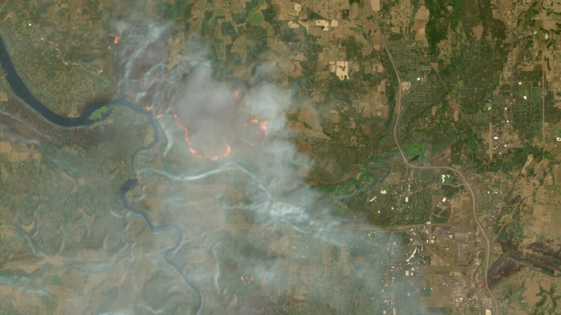
The Copernicus Browser has added a new feature to visualize wildfires. This update comes during a record wildfire season in Europe.
The Copernicus Browser, Europe's free satellite service, has introduced a new feature to help track wildfires. This addition is particularly timely, given the current record wildfire season. The browser now allows users to visualize wildfires, providing valuable insights into the spread and intensity of these fires.
The Copernicus program is a European Earth observation program that provides a wide range of data and services. The browser is a key tool in this program, offering access to satellite data and imagery. With the new wildfire visualization feature, users can now monitor wildfires more effectively, which can aid in firefighting efforts and support decision-making.
The record wildfire season has highlighted the need for effective tracking and monitoring of wildfires. The Copernicus Browser's new feature is a significant step in this direction, providing a valuable resource for those involved in wildfire management and response.
Go Deeper
What is the Copernicus Browser?
The Copernicus Browser is a free satellite service provided by Europe's Copernicus program, offering access to satellite data and imagery. It is a key tool for monitoring and tracking various environmental phenomena, including wildfires.
How does the wildfire visualization feature work?
The wildfire visualization feature on the Copernicus Browser uses satellite data to provide a visual representation of wildfires. This allows users to track the spread and intensity of wildfires, aiding in firefighting efforts and decision-making.
Why is this feature important during a record wildfire season?
The new feature is important because it provides a valuable tool for tracking and monitoring wildfires. This can aid in firefighting efforts, support decision-making, and help mitigate the impact of wildfires.
Who can use the Copernicus Browser and its wildfire visualization feature?
The Copernicus Browser and its wildfire visualization feature are available to anyone, including firefighters, emergency responders, and the general public. This makes it a useful resource for those involved in wildfire management and response.
What other data and services does the Copernicus program provide?
The Copernicus program provides a wide range of data and services, including satellite data and imagery, land, ocean, and atmospheric monitoring, and climate change tracking. These services support various applications, such as environmental monitoring, urban planning, and emergency response.
More technology
 technology
Amazon Announces First Off-the-Grid Data Center
Amazon has announced its first off-the-grid data center. The company is working to increase its use of renewable energy.
Aug 11 technology
US Appeals Court Allows Lawsuits Against Social Media Companies to Proceed
A US Appeals Court has ruled that social media companies like Meta and TikTok must face thousands of lawsuits over online safety. The court determined
Aug 10 technology
Zuckerberg's Superyacht Fails to Respond to Emergency Call
Mark Zuckerberg's superyacht and its support ship were slow to respond to a Coast Guard emergency call. The incident involved a stranded boat that req
Aug 10